Photography Now and Then #9

Today’s photo1: The Final Frontier – The “planet” looking circles in this quilt inspired its Star Trek based name (photo taken with Pentax K-3 II; selective coloring and other photo editing with PaintShop Pro).
With a quilter in the house, we always have a quilt on the bed. When it gets too cold for the heat pump to keep the house at our normal winter setting of 68°F, a second quilt keeps us warm and and snug until morning when we start a fire in our fireplace insert to augment the heat pump.
Yes it does get cold in Arkansas. We saw single digits the first week of January. On February 2, 1951, the area saw -14°F. That’s way colder than I ever want to see here!

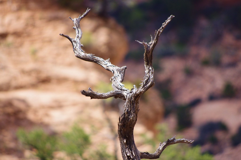
Photo Favorite2: Likely a dead Utah juniper or similar tree. Navajo National Monument, Arizona, October 1, 2011
Utah Juniper
Juniperus osteosperma (Utah juniper; syn. J. utahensis) is a shrub or small tree reaching 3–6 m (rarely to 9 m) tall. It is native to the southwestern United States, in Utah, Nevada, Arizona, western New Mexico, western Colorado, Wyoming, southern Montana, southern Idaho and eastern California. It grows at moderate altitudes of 1,300–2,600 metres (4,300–8,500 ft), on dry soils, often together with Pinus monophylla.3
Navajo National Monument
Navajo National Monument is a National Monument located within the northwest portion of the Navajo Nation territory in northern Arizona, which was established to preserve three well-preserved cliff dwellings of the Ancestral Puebloan People: Broken Pottery (Kitsʼiil), Ledge House (Bitátʼahkin), and Inscription House (Tsʼah Biiʼ Kin). The monument is high on the Shonto plateau, overlooking the Tsegi Canyon system, west of Kayenta, Arizona. It features a visitor center with a museum, two short self-guided mesa top trails, two small campgrounds, and a picnic area. Rangers guide visitors on free tours of the Keet Seel and Betatakin cliff dwellings. The Inscription House site, further west, is currently closed to public access.
The Sandal Trail is an accessible self-guided walk that provides views of the spectacular canyonlands and rugged topography near the visitor center. Interpretive signs provide information on local flora and other topics. The 1-mile (1.6 km) round-trip trail ends at an overlook of the Betatakin ruins across the 560-foot-deep (170 m) Betatakin Canyon. The National Monument was listed on the National Register of Historic Places on October 15, 1966.4
Where the highway ends, the Ancestral Puebloan Wild West Prehistory Begins…
The prehistoric Puebloan Ancestors built Tsegi Phase villages within the natural sandstone alcoves of our canyons. The resilient Ancestral Puebloans paved the way for current Native American groups in the Southwest region. These villages, which date from AD 1250 to 1300, thrill all who visit with original architectural elements such as roof beams, masonary walls, rock art, and hand and foot holds.5
- Today’s Photo is a photo that is almost always taken the day of the blog post. In some instances, posts may be backdated if internet access is not available on the day of the photo or other reasons prevent posting Now and Then.
- Photo Favorite is a randomly selected older photograph from a batch of photos specifically “curated” for Now and Then.
- Juniperus osteoperma – Wikipedia
- Navajo National Monument – Wikipedia
- Navajo National Monument – National Park Service
Note: Reference links were accessed on the date the blog post was published, unless otherwise stated.

