Author: Mike Goad
Published: September 7, 2022
Camping and Travel Daily Image No. 76

The Sawtooth Mountains, near Stanley, Idaho, July 29, 2010
Sawtooth Range (Idaho)
Wikipedia (accessed 9/3/22)
The Sawtooth Range is a mountain range of the Rocky Mountains in central Idaho, United States, reaching a maximum elevation of 10,751 feet (3,277 m) at the summit of Thompson Peak. It encompasses an area of 678 square miles (1,756 km2) spanning parts of Custer, Boise, Blaine, and Elmore counties, and is bordered to the east by the Sawtooth Valley. Much of the mountain range is within the Sawtooth Wilderness, part of the Sawtooth National Recreation Area and Sawtooth National Forest.
The mountains were named for their jagged peaks
There are 57 peaks with an elevation of over 10,000 feet (3,000 m) in the Sawtooth Range, all falling between 10,000 to 10,751 feet (3,048 to 3,277 m) on Thompson Peak, the highest point in the range. Another 77 peaks fall between 9,000 and 10,000 feet (2,700 and 3,000 m)
Like this:
Like Loading...
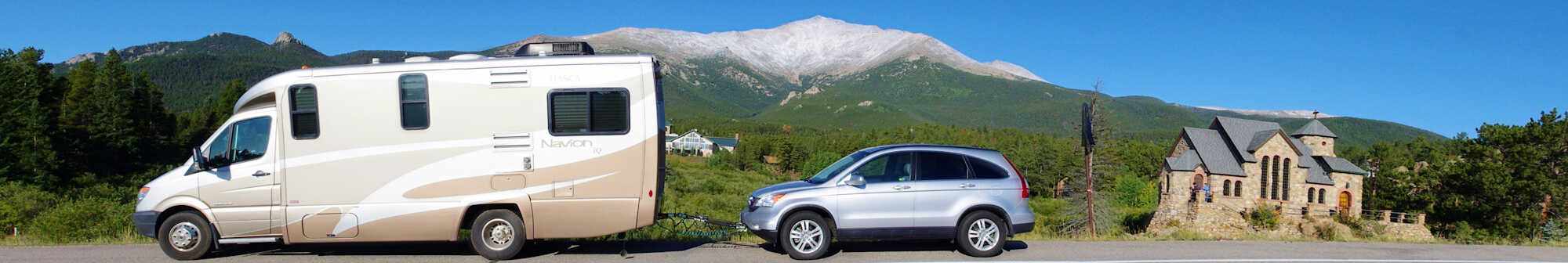
Author: Mike Goad
Published: September 6, 2022
Camping and Travel Daily Image No. 75
 and several other RVs in Bozeman, Montana, stopped for lunch, August 1, 2010")
Our small Class C motorhomes (on left) and several other RVs in Bozeman, Montana, stopped for lunch, August 1, 2010
Even though it was 12 years ago, I actually remember this stop at a Walmart in Montana.
As Said in an earlier post about another Montana stop:
When we are traveling from one place to the next, we like to stop periodically just to get out, stretch, and loosen up our aching bones. Ideally, a nice rest area or city park would be a nice place for it. Unfortunately, more often than not, the more readily available stopping place would be a big box store like Walmart, Lowes, or Home Depot, where we use the restroom and take 2 or 3 laps around the outer aisles inside the store.
When it’s around lunchtime, we’ll eat before heading back out on the road, as did, in this image four other RV travelers in two other RV types: two Class A motorhomes and two travel trailers.
Like this:
Like Loading...
Author: Mike Goad
Published: September 5, 2022
Camping and Travel Daily Image No. 74

View from Pumice Point, Lake Yellowstone, Yellowstone National Park, September 3, 2014
On this trip, we had already visited Yellowstone earlier in the summer. After visiting Glacier National Park, we decided we weren’t yet ready to go home and headed to Grand Teton National which we had skipped earlier in the trip.
The wind coming off Lake Yellowstone was extremely strong and, with an average water temperature of 41°, quite cold after traveling 4 miles across the lake’s West Thumb.
Like this:
Like Loading...
Author: Mike Goad
Published: September 4, 2022
Camping and Travel Daily Image No. 73

Jackson, Wyoming, September 3, 2014. It’s normal to see RVs traveling through this intersection.
Jackson, Wyoming
We literally don’t know how many times we’ve been to or through Jackson, Wyoming.
My first visit here was with my grandparents and my sister 59 years ago when I was 11 years old and she was 9. While I don’t remember a lot about the town, it is decidedly different from what people find today. Years later, when we lived nearby in Idaho in 1973 and again from 1977 to 1980, we passed through and visited the town numerous times. Since we moved to Arkansas, our visits have been on the order of every few years
The town isn’t the reason for our visits. It just happens to be close to a couple of our favorite places, Grand Teton and Yellowstone National Parks.
Some people think Jackson and Jackson Hole are the same thing. They aren’t. Jackson is the city while Jackson Hole is a valley that stretches 60 miles along the Teton Mountains and includes Jackson, Teton Village, Wilson, Moose, Moran Junction, and much of Grand Teton National Park.
A strong local economy, primarily due to tourism, has allowed Jackson to develop a large shopping and eating district characterized by a large number of art galleries, custom jewelers, and designer clothing retailers centered on the town square. (Wikipedia)
Like this:
Like Loading...
Author: Mike Goad
Published: September 3, 2022
Camping and Travel Daily Image No. 72
 spanning the Missouri National Recreational River between Nebraska and South Dakota, September 16, 2014, at Yankton.")
View from Meridian Highway Bridge (now a pedestrian bridge) spanning the Missouri National Recreational River between Nebraska and South Dakota, September 16, 2014, at Yankton.
Missouri National Recreational River
A United States National Park
Wikipedia
Accessed 9/2/2022
The Missouri National Recreational River is a National Recreational River located on the border between Nebraska and South Dakota. The designation was first applied in 1978 to a 59-mile section of the Missouri River between Gavins Point Dam and Ponca State Park. In 1991, an additional 39-mile section between Fort Randall Dam and Niobrara, Nebraska, was added to the designation. These two stretches of the Missouri River are the only parts of the river between Montana and the mouth of the Missouri that remain undammed or unchannelized. The last 20 miles of the Niobrara River and 6 miles of Verdigre Creek were also added in 1991.
The Missouri National Recreational River is managed by the National Park Service, with headquarters located in Yankton, South Dakota. Visitor centers are located at Ponca State Park, Niobrara State Park, and the Lewis and Clark Visitor Center at Gavins Point Dam, overlooking Lewis and Clark Lake. It lies in parts of Boyd, Cedar, Dixon, and Knox counties in Nebraska, and Bon Homme, Charles Mix, Clay, Union, and Yankton counties in South Dakota.
Like this:
Like Loading...