Leaving Rocky Mountain National Park on September 16, 2011, our next destination was several thousand feet lower and on the western side of the state – Grand Junction, Colorado.
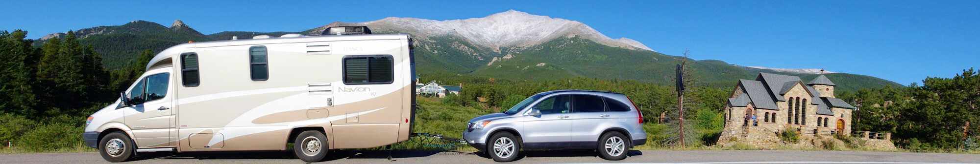
 About nine miles south of Estes Park on Colorado 7, we stopped to take pictures of the Chapel on the Rock – officially St. Catherine of Siena Chapel – on the grounds of Saint Milo Retreat Center. The chapel is built on an large piece of granite that the Colorado highway department once planned to dynamite to widen and straighten the adjacent highway. Dedicated in 1936, the chapel was built from local stone hauled in by mule carts.
In November, 2011, a fire heavily damaged portions of the St. Milo Retreat Center. The chapel, several hundred feet away was not damaged.

Our drive for the day was about 300 miles. The first part was on mountain 2-lane highways down to Interstate 70. Traffic was quite light, certainly less than it would have been if we had gone through Boulder and along the foothills of the Front Range as we did in 2009.
I70 meanders up, down, around and through the Colorado mountains between Denver and and Grand Junction. Our little motorhome did pretty good duty traveling over this road once again, though the CRV it was towing was 6 model years newer than the last time.
“The Eisenhower Tunnel, with a maximum elevation of 11,158 feet (3,401 m) and length of 1.7 miles (2.7 km), is the longest mountain tunnel and highest point along the Interstate Highway System.” (Wikipedia.)
We stopped in Vail for lunch and a stretch break. Often, when there isn’t a rest area handy, we’ll take a break after an hour or two of driving by stopping at a “big box” store. Most of them are large enough that we can loosen up by taking a couple of laps walking around inside the store. In Vail, we stopped at WalMart and, once we were loosened up, went back out to the camper and had lunch in our camper.
 Our next stop was a rest area in Glenwood Canyon, a rugged and scenic canyon on the Colorado River. This area is one of the most scenic natural features along the U.S. Interstate highway System. Foot access is available for hiking a four rest areas in the canyon. The highway through the canyon was one of the final pieces of the system to open to traffic and was one of the most expensive per mile constructed in the United States. In its 12.5 mile length, there are three tunnels, 40 bridges and viaducts, and miles of retaining walls. “Through a significant portion of the canyon, the eastbound lanes extend cantilevered over the Colorado River and the westbound lanes are suspended on a viaduct several feet above the canyon floor.” (Wikipedia)
The trip along I 70 was a gradual transition from high mountain forests and tundra west of Denver to the high desert of western Colorado and Utah.
We would be camping in the Grand Junction, 4,593 ft (1,397 m), area for the next 4 nights and would be in desert country for a good portion of the rest of the trip.
